How Construction Companies Use 360° Documentation to Improve Project Management, Safety & Client Communication
Discover how construction companies use 360° documentation to monitor site progress, improve safety, reduce disputes, and impress clients. Learn how 360 VR Photography delivers professional 360° construction documentation services across India.
GOOGLE MAP 360 IMAGE
How Construction Companies Use 360° Documentation to Improve Project Management, Safety & Client Communication
The construction industry is shedding its analog skin at a breakneck pace. From drone-based site mapping to Building Information Modeling (BIM), modern technology is fundamentally restructuring how infrastructure projects are planned, tracked, and brought to completion.
Among these digital tools, 360° visual documentation has emerged as a major competitive advantage, allowing progressive construction teams to log and preserve every single phase of a project's lifecycle in immersive spatial detail.
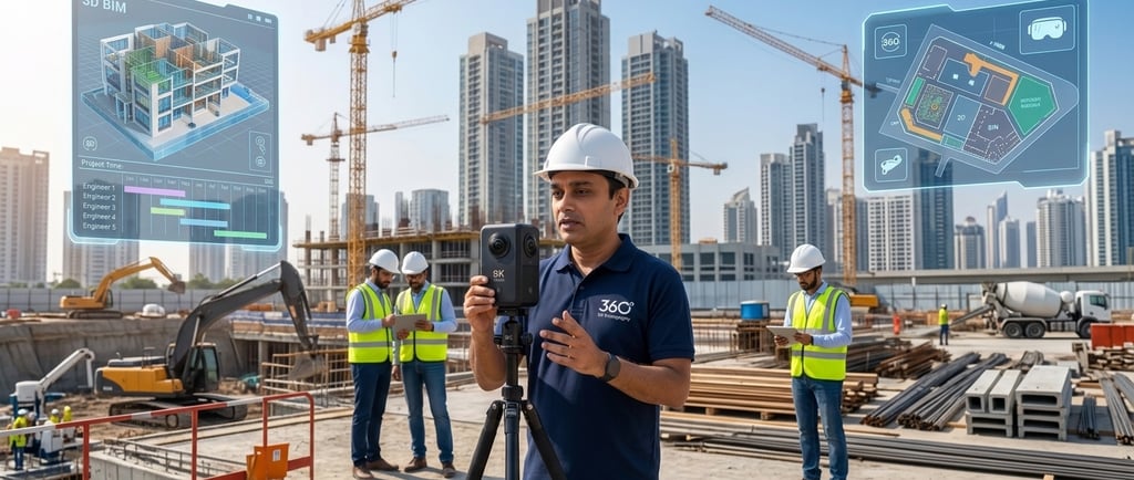
Unlike traditional site photography—which only offers a narrow, highly selective viewport—360° documentation records the entire surrounding environment in a single snapshot. It gives project managers, structural engineers, architects, sub-contractors, and clients the power to virtually revisit the active job site at any time, from any device, anywhere in the world.
At 360 VR Photography, we deliver professional-grade 360° construction site documentation, virtual progress reports, drone aerial imaging, and comprehensive digital project archives. Our mission is simple: helping construction companies cut down on travel costs, optimize cross-team coordination, and eliminate expensive structural rework.
What is 360° Construction Documentation?
360° construction documentation is the systematic process of mapping an entire site using high-resolution panoramic captures at scheduled intervals throughout the project lifecycle.
Instead of leaving massive visual blind spots, these periodic captures stack together to build an unalterable, step-by-step visual timeline of the build. This structured archive documents:
Pre-construction: Original site conditions and initial excavation.
Structural Substructure: Foundation laying, rebar spacing, and concrete pours.
MEP Installations: The exact paths of Mechanical, Electrical, and Plumbing lines before they are closed up.
In-Wall Layouts: Hidden HVAC ducting and insulation layers.
Interior Finishes: Drywall placement, painting, fixtures, and interior styling.
Handover & Delivery: A clean, visual "as-built" verification record for the client.
The Core Pitfalls of Traditional Site Photos
Walk onto almost any standard job site, and you’ll see engineers snapping quick progress photos on their personal smartphones. While well-intentioned, this loose approach causes a few persistent operational headaches:
The "Missing Angle" Problem: A phone photo only captures what the photographer is pointing at. Weeks later, when a dispute arises about a utility pipe positioned just two feet to the left of the frame, the photo is completely useless.
Siloed Communication: Misaligned updates between the field crew and remote project consultants lead to long approval delays, keeping expensive machinery idle on-site.
Vague Historical Records: When hidden plumbing or wiring issues crop up after the walls are finished, locating the exact point of failure turns into a destructive guessing game behind the drywall.
On popular industry forums like Reddit’s r/construction, builders frequently discuss how moving to full visual documentation cuts down on field arguments and keeps out-of-town clients perfectly aligned with actual project milestones.
How 360° Documentation Elevates Project Execution
1. Flawless Project Tracking & Management
By utilizing time-lapse progress comparison software, you can virtually stand in the exact same spot across different weeks of construction. You can easily slide between the bare stud framework of month one and the completed interior space of month two, ensuring the build is tracking precisely against the master schedule.
2. Bulletproof "Behind-the-Wall" Verification
One of the most valuable aspects of spatial documentation is capturing active MEP (Mechanical, Electrical, and Plumbing) layouts right before the drywall goes up. Having a permanent, accessible record of exactly where conduit lines, water pipes, and structural supports sit makes future renovations or emergency maintenance simple and safe.
3. Radical Transparency in Client Communication
Instead of sending your institutional investors or clients long, text-heavy PDF status updates, you can provide an interactive link. They can virtually tour the site, zoom in on the finishing details, and visually confirm progress from their desktop or phone, building massive long-term trust.
4. Reduced Disputes and Rework Costs
If a sub-contractor accidentally damages a pre-installed asset, or if a structural deviation occurs, your 360° timeline acts as an unassailable visual truth. You can easily pinpoint exactly when a change happened, resolving liability discussions in minutes rather than weeks.
5. Enhanced Safety & Remote Auditing
Safety officers can audit active work zones, check safety rail compliance, and review scaffolding setups remotely without stepping into hazardous areas. It reduces overall foot traffic in high-risk zones while keeping safety oversight high.
Recommended Video: Exploring 360° Tours in the Construction Sector
To see exactly how modern engineering and construction firms embed immersive 360° photography and spatial documentation directly into their everyday workflows, we highly recommend watching this insight-packed industry overview on YouTube:
Video Title: Exploring 360 Virtual Tours in the AEC Industry
Channel: MSBIM
Link: Watch the AEC Industry 360° Virtual Tour Breakdown on YouTube
Frequently Asked Questions (FAQ)
Can 360° site documentation link directly up to our existing BIM software?
Yes, absolutely. High-end site documentation platforms allow us to cross-reference and pin the captured 360° panoramic images directly to your active architectural floor plans or structural BIM models. This gives your design team a side-by-side comparison of the digital model versus real-world site reality.
How do you handle poor or limited lighting during the structural phase?
Our technical on-site imaging teams deploy professional-grade 360° capture rigs equipped with advanced Auto Exposure Bracketing (AEB) and low-light HDR capabilities. This ensures that even unlit basements, elevator shafts, or deep industrial interior bays are documented with complete clarity and minimal grain.
Is our sensitive project data safe when hosting these tours online?
Security is treated as a top priority. Every virtual tour platform we deploy can be locked down with robust password encryption, restricted to authorized corporate email domains, or deployed entirely via your company’s private intranet server network to ensure zero exposure of proprietary project information.
Partner With India’s Immersive Construction Documentation Experts
Documenting complex, multi-crore infrastructure projects with high precision requires specialized technical skill. With over ten years of hands-on experience in immersive spatial technology, 360 VR Photography builds robust, high-fidelity site monitoring solutions tailored for real estate developers, industrial companies, and government contractors across India.
Our Comprehensive Service Suite Includes:
Ultra-HD 8K/11K Spatial Progress Documentation
Interactive Time-Shift Progress Tracking Systems
High-Resolution Drone Surveys & Aerial Site Overviews
Digital Twin Integration & Asset Mapping
Password-Protected Web Hosting Portals
Bring your job site directly to your stakeholders' screens. Connect with our team today to discuss your project scale, set up a custom capture schedule, or request a live interactive walkthrough of our past documentation projects.
Founder & Lead Specialist: Viral Gala
Company: 360 VR Photography
Phone / WhatsApp: +91 99203 22366
Websites: www.360vrphotography.in | www.360vrphotography.com

Experience
Engaging virtual tours for real estate and events.
Innovative
Immersive
info@360vrphotography.in
+91 9920322366